

general situation
An Atlantic depression will affect the region from Friday evening until Saturday afternoon, bringing cold air at upper levels. From Sunday, a new ridge of high pressure will bring more settled conditions.
today
Thursday 22 October
release: 21-10-2026 12:30 CEST
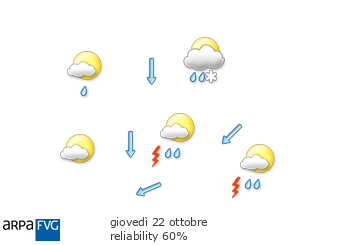
Moderate rain and a few thunderstorms overnight and in the morning, especially in the eastern areas. Strong north-easterly winds. Conditions will improve during the day, starting in the west, with partly cloudy skies developing in the afternoon.
| min. temperature (°C) | 7/10 | |
| max. temperature (°C) | 16/19 | |
| thermal zero height (m) | 2000 | |
| snowfall level (m) | 1500 | |
| Prealps | plain | |
|---|---|---|
| prob. of widespread precipitations (%) | 70 | 70 |
| thunderstorms probability (%) | 20 | 50 |
| 4 | 12 | 20 | |
|---|---|---|---|
| diurnal evolution |
 |
 |
 |
tomorrow
Friday 23 October
release: 22-10-2026 13:21 CEST
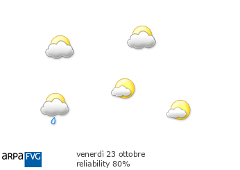
Largely clear skies early in the morning. Cloud will increase during the day, with moderate rain expected in the evening and the possibility of a few showers over the eastern plains.
| min. temperature (°C) | 6/8 | |
| max. temperature (°C) | 16/18 | |
| thermal zero height (m) | 2200 | |
| snowfall level (m) | 1900 | |
| Prealps | plain | |
|---|---|---|
| prob. of widespread precipitations (%) | 80 | 80 |
| thunderstorms probability (%) | 10 | 30 |
| 4 | 12 | 20 | |
|---|---|---|---|
| diurnal evolution |
|
|
|
the day after tomorrow
Saturday 24 October
release: 22-10-2026 13:21 CEST
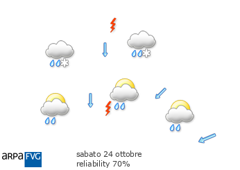
Cloudy with intermittent moderate rain and the possibility of a few scattered showers. Maximum temperatures will fall significantly. In the afternoon, the snow level may drop to 1000 metres in the Alps and 1200 metres in the Pre-Alps. Moderate northerly winds will develop from the afternoon.
| min. temperature (°C) | 8/10 | |
| max. temperature (°C) | 12/14 | |
| thermal zero height (m) | 2200 → 1700 | |
| snowfall level (m) | 1900 → 1100 | |
| Prealps | plain | |
|---|---|---|
| prob. of widespread precipitations (%) | >90 | 80 |
| thunderstorms probability (%) | 30 | 40 |
| 4 | 12 | 20 | |
|---|---|---|---|
| diurnal evolution |
 |
 |
|
trend for SundaySun
Sunday 25 October
release: 22-10-2026 13:22 CEST
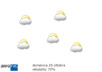
Mostly cloudy with possible sunny spells developing from the afternoon. Moderate Bora winds will blow along the coast overnight, easing during the morning.
| temp. (°C) | min | max | med | |
|---|---|---|---|---|
| plain | 3/7 | 13/16 | 2000 m | 0 |
| coast | 8/10 | 15/17 | 1000 m | 6 |
| 4 | 12 | 20 | |
|---|---|---|---|
| diurnal evolution |
|
|
|
trend for MondayMon
Monday 26 October
release: 22-10-2026 13:22 CEST
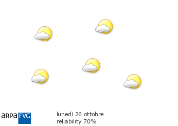
Generally variable cloud, at times temporarily cloudy as bands of medium- and high-level cloud pass through. Temperatures will rise, with the freezing level above 3000 metres.
| temp. (°C) | min | max | med | |
|---|---|---|---|---|
| plain | 4/7 | 17/19 | 2000 m | 6 |
| coast | 9/11 | 17/19 | 1000 m | 10 |
| 4 | 12 | 20 | |
|---|---|---|---|
| diurnal evolution |
|
|
|
